Quantcast
Jump to content

Recommended Posts

Posted

Browning Fork ATV Trails

NOTES: Southeast of Logan and just south of Man, the Browning Fork ATV Trails at the Rockhouse Trailhead is part of the Hatfield-McCoy Recreation Area, a 500 mile multi-use trail system combining singletracks and fire roads on corporate-owned property. Presently, the system consists of five loops serviced by 5 restroom-equiped trailheads.

The Rockhouse / Browning Fork system has 115 miles of trail.

To reach the Rockhouse Trailhead for the Browning Fork ATV Trails: Driving north or south on Rt.119, take the Logan exit (Walmart). Follow Rt. 73 east to Rt. 10. Take Rt. 10 for 16 miles to Rt. 80 south. Bear right onto Rt. 80, cross the bridge and the railroad tracks. Cross the river and make a left at the stop sign. Follow the road approximately ½ mile to the trailhead center.

Note: a helmet, eyewear and boots are required on the Hatfield and McCoy Trail System. Also, double riding is not permitted. The machine must be equipped with a spark arrestor and muffler. Annual, multi-day and one-day permits are available.

Important: before riding this trail area, make sure to contact the local land manager regarding current registration, equipment and gear requirements. Also, verify open/closure dates and times.

FOR MORE INFORMATION: HMRA (800) 592-2217; WV Tourims (800) CALL-WVA; Tug Valley Tourism (304) 235-5240; Coalfield Tourism (304) 792-8519; Hatfield-McCoy Reservations (304) 369-7260

Posted

Buffalo Mountain ATV Trails

NOTES: Southwest of Logan and east of Williamson, the Buffalo Mountain ATV Trails at the Reverend Compton Trailhead is part of the Hatfield-McCoy Recreation Area, a 500 mile multi-use trail system combining singletracks and fire roads on corporate-owned property. Presently, the system consists of five loops serviced by 5 restroom-equiped trailheads.

The Buffalo Mountain / Reverend Compton Park system has 95 miles of trails.

To reach the Reverend Compton Trailhead for the Buffalo Mountain ATV Trails: From Rt. 119, follow Rt. 52 south through Williamson. The trailhead center is eight miles outside of Williamson. The town of Matewan (depicted on the trail map) allows motorized trail users to ride into town. Please ride responsibly and obey all road rules. Twenty minutes from Williamson. Forty-five minutes from Bearwallow and Rockhouse Trailheads.

Note: a helmet, eyewear and boots are required on the Hatfield and McCoy Trail System. Also, double riding is not permitted. The machine must be equipped with a spark arrestor and muffler. Annual, multi-day and one-day permits are available.

Important: before riding this trail area, make sure to contact the local land manager regarding current registration, equipment and gear requirements. Also, verify open/closure dates and times.

Posted

Dingess Rum ATV Trails

NOTES: East of Logan and Stollings, the Dingess Rum ATV Trails at the Bear Wallow Trailhead is part of the Hatfield-McCoy Recreation Area, a 500 mile multi-use trail system combining singletracks and fire roads on corporate-owned property. Presently, the system consists of five loops serviced by 5 restroom-equiped trailheads.

The Dingess Rum / Bear Wallow trail system has 125 miles of trails.

To reach the Bear Wallow Trailhead for the Dingess Rum ATV Trails: Driving north or south on Rt. 119, take the Logan exit (Walmart). Follow Rt. 73 east to Rt. 10 south. Pass the town of Logan and make a left onto Rt. 17 north. Go under the train tressel (Only 9' high). Make a left onto Red Campbell Road at the Wanda Trailer Park. Make the second right and follow the road to the trailhead center. If you cannot fit under the train tressel, make a left (across from the Logan Professional Building) onto Rt. 17 truck route, follow the signs to Rt. 17 north and make a left.

Note: a helmet, eyewear and boots are required on the Hatfield and McCoy Trail System. Also, double riding is not permitted. The machine must be equipped with a spark arrestor and muffler. Annual, multi-day and one-day permits are available.

Important: before riding this trail area, make sure to contact the local land manager regarding current registration, equipment and gear requirements. Also, verify open/closure dates and times.

Posted

Indian Ridge ATV Trails - East

NOTES: In McDowell County, the Indian Ridge Trail System is part of the Hatfield-McCoy Recreation Area, a 500 mile multi-use trail system combining singletracks and fire roads on corporate-owned property. It starts at the Ashland Trailhead and winds through the hills.

The Indian Ridge Trail System has one trailhead with a 2 acre parking area and restrooms. This trail offers a nice variety of trails for all difficulty levels. The breakdown in trail percentage for this trail system is as follows: 24% are green trails (easiest), 47% are blue trails (more difficult), 20% are black trails (most difficult), and 9% are orange trails (single track). This trail system offers community access to the Town of Norhfork and the Town of Keystone.

The Ashland Trailhead of the Indian Ridge Trail System is located a short distance from I-77 near Princeton and Bluefield West Virginia. Driving north or south on Interstate-77, take Exit 1, follow truck route US 52 N through Bluefield to US 52 North 26.3 miles to Northfork, make a sharp right turn North onto Country Road 17 (Northfork-Ashland Road). Continue on County Road 17 another 6.5 miles to the entrance of the Ashland Trailhead.

Posted

Indian Ridge ATV Trails - West

NOTES: In McDowell County, the Indian Ridge Trail System is part of the Hatfield-McCoy Recreation Area, a 500 mile multi-use trail system combining singletracks and fire roads on corporate-owned property. It starts at the Ashland Trailhead and winds through the hills.

The Indian Ridge Trail System has one trailhead with a 2 acre parking area and restrooms. This trail offers a nice variety of trails for all difficulty levels. The breakdown in trail percentage for this trail system is as follows: 24% are green trails (easiest), 47% are blue trails (more difficult), 20% are black trails (most difficult), and 9% are orange trails (single track). This trail system offers community access to the Town of Norhfork and the Town of Keystone.

The Ashland Trailhead of the Indian Ridge Trail System is located a short distance from I-77 near Princeton and Bluefield West Virginia. Driving north or south on Interstate-77, take Exit 1, follow truck route US 52 N through Bluefield to US 52 North 26.3 miles to Northfork, make a sharp right turn North onto Country Road 17 (Northfork-Ashland Road). Continue on County Road 17 another 6.5 miles to the entrance of the Ashland Trailhead.

Posted

Little Coal River ATV Trails

NOTES: South of Charleston and north of Danville, the Little Coal River Trail at the Water Ways Trailhead is part of the Hatfield-McCoy Recreation Area, a 500 mile multi-use trail system combining singletracks and fire roads on corporate-owned property. Presently, the system consists of five loops serviced by 5 restroom-equiped trailheads.

When complete, the Little Coal River ATV Trail system will have 60 miles of trails. This system has the most easy trails of any part of the Hatfield-McCoy System.

To reach the Water Ways Trailhead for the Little Coal River ATV Trails: Driving north or south on SR119, take the Waterways Exit that is just north of the water park. Follow th eroad approximately 0.5 miles to the trailhead. It is about 18 miles south of Charleston and 10 miles north of the Madison/Danville Exit.

Note: a helmet, eyewear and boots are required on the Hatfield and McCoy Trail System. Also, double riding is not permitted. The machine must be equipped with a spark arrestor and muffler. Annual, multi-day and one-day permits are available.

Posted

Pinnacle Creek ATV Trails

NOTES: Southeast of Logan and Pineville, the Pinnacle Creek ATV Trails are part of the Hatfield-McCoy Recreation Area, a 500 mile multi-use trail system combining singletracks and fire roads on corporate-owned property. Presently, the system consists of five loops serviced by 5 restroom-equiped trailheads.

Near Pineville in Wyoming County, the Pinnacle Creek Trail System consists of 105 miles of trails across private land. The rolling trails wind along river and through dense forest on reclaimed coal mining land. The best place to start is the Castle Rock Trailhead. The breakdown in trail percentage is as follows: 44% are green trails (easiest), 35% are blue trails (more difficult), 21 percent are black trails (most difficult), and 0% are orange trails (single track only). This trail system has direct access to food, fuel, and lodging in the city of Pineville, West Virginia.

Castle Rock Trailhead Directions

Driving north or south on Rt.119, take the Logan exit (Walmart). Follow Rt. 73 east to Rt. 10. Take Rt. 10 for 45 miles to Pineville. Follow Rt. 10 South through Pineville. Turn onto Rt. 16 South. Make a left at Pinnacle Creek Road and follow signs 3 miles to the trailhead. Signage will be posted to aid your travels. (Approximately 45 miles)

Driving north or south on I-77, take the Robert C. Byrd exit near Beckley. Travel south on Rt. 16 toward Sophia 3.5 miles. Make right on to Rt. 97/54 toward Twin Falls State Park and travel approximately 12 miles. Then turn right, continuing toward Twin Falls State Park on Rt. 97. At the intersection of Rt. 97 and Twin Falls State Park entrance, make a right continuing on Rt. 97 and then driving 7 miles toward Pineville. When reaching the intersection of Rt. 97 and Rt. 10, bear left onto Rt. 10 south. Travel approximately 1 mile and turn right onto Route 16 south. Travel .5 miles then turn left following the signs for Castle Rock trailhead. Finally, drive 2.8 miles to the trailhead center which is located on the left. This trail system is located approximately 5 miles to the nearest town of Pineville.

Note: a helmet, eyewear and boots are required on the Hatfield/McCoy Trail System. Also, double riding is not permitted. The machine must be equipped with a spark arrestor and muffler. Annual, multi-day and one-day permits are available.

Posted

I do, when I ride them. I only put adds into the trail section where I can give my own perspective. Sorry bot. but after my september road trip, I will hopefully be adding MANY trails nation wide.

  • 1 month later...
  • 2 weeks later...
Posted
When is the best time to ride the trails? Spring, winter, fall, summer?

Yes........

:drool5c:

-TomD

Posted

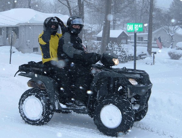
Each season has its advantages. Spring is often rainy, so if you like mud, choose the Spring. It usually has warm temperatures. Summer has advantages. If you like warm temperatures with low humidity, choose the month of June. If you like dry weather, choose July or August. Autumn is a popular season. September has warm days and cooler nights. October has beautiful scenery, but it is a high traffic month. Winter can be cold, so dress in layers when riding during the Winter. Due to the loss of the leaves, visibility is unbelievable! Also, the number of riders is few. Some riders like to ride in the snow. January and February is a good month for that. It is like you have the trails to yourselves.

If you have other questions, let me know.

Join the conversation

You can post now and register later. If you have an account, sign in now to post with your account.
Note: Your post will require moderator approval before it will be visible.

Guest
Reply to this topic...

×   Pasted as rich text.   Paste as plain text instead

  Only 75 emoji are allowed.

×   Your link has been automatically embedded.   Display as a link instead

×   Your previous content has been restored.   Clear editor

×   You cannot paste images directly. Upload or insert images from URL.

  • Similar Forum Topics

    • By Gwbarm
      Have you ever been on the trail and your tire valve goes bad. No way to break down the wheel and replace it. A lot of you probably know about this already i had heard of it but never used one. Just punch out the old one insert and tighten down the nut


      So far it has worked very well.
    • By 1998Zuki250
      Looking to see if anyone has any input on ATV Tires? 1998 Suzuki quadrunner LTF250
    • By AnthonyT
      In search of my first ATV? What are good older 4x4 models?
    • By Ajmboy
      So we are almost a month into winter and I've been so busy working on my house that up until today, I didn't realize that we just haven;t gotten any real snow yet to warrant putting the plow on my grizzly. So that got me thinking, what are the latest plows out there and what ATV plows are the best? I've got 2 snow plows for my grizzly, a quadboss pile driver atv plow set up and a snowsport ATV plow. They are both a bit dated now and I tend to stick with the snowsport due to ease of use and I just like it so much. So if you have a plow on your ATV, please let us know what it is and post a picture with your atv/plow would be awesome. Would also like to know what you like and dislike about it.
      This is back a while when I did a write up on these 2 plows.... in 2009 I got the snowsport and in 2012 I got the quadboss.
       
    • By Panupong Pradchaphet
      I have a Sportsman 450 HO and almost killed my self when loading it on my truck with ramps.  It rolled off the top of the ramps and tailgate and nearly landed on me.  I now want to winch the ATV in to the truck.  My question is are the front side bed tiedowns in my 2011 RAM strong enough to winch to without distorting the hooks or sides of the bed?
×
×
  • Create New...